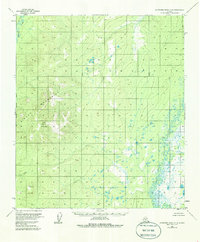
1953 Map of Kantishna River A-6
USGS Topo · Published 1986About this map
Sischu Mountains dominate the western landscape of this mid-century Alaskan interior survey, rising to the prominent peak of Sischu Mountain VABM 3510 (Camel). This area of the Yukon-Koyukuk region reflects a wilderness primarily defined by its drainage systems and high-altitude markers. The North Fork Kuskokwim River meanders through the southeastern portion of the quadrangle, while the Sethkokna River drains the northwestern corner, illustrating the complex hydrology of the subarctic basin. Surveyed via photogrammetric methods in the early 1950s, the map documents a land without roads or trails, where geographical reference points like VABM 2230 (Corner) and Sischu Creek served as the primary navigators for early geological and land management teams.
Find a feature on this map
7 named features on this map. Tap any name to fly to it.
Don’t see what you’re looking for? This feature index may not catch every label — zoom into the map to look around manually.
Map Details
Editions of this 1953 Kantishna River A-6 Map
4 editions found
Other maps of this area

1948 · Kantishna River
USGS Topo · 1:250,000

1950 · Medfra
USGS Topo · 1:250,000

1951 · Kantishna River
USGS Topo · 1:250,000

1951 · Ruby
USGS Topo · 1:250,000

1952 · Mount McKinley
USGS Topo · 1:250,000

1952 · Ruby B-1
USGS Topo · 1:63,360

1952 · Ruby A-1
USGS Topo · 1:63,360

1952 · Kantishna River
USGS Topo · 1:250,000

1952 · Kantishna River B-6
USGS Topo · 1:63,360

1952 · Kantishna River A-5
USGS Topo · 1:63,360