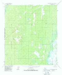
1953 Map of Kantishna River A-6
USGS Topo · Published 1988About this map
Sischu Mountains dominate the western half of this interior Alaskan landscape, rising to peaks such as Sischu Mountain and the high point marked VABM 3510 Camel. The terrain transition is sharp, moving from these elevated ridges down into a watery expanse of swamps and muskeg to the east. The North Fork Kuskokwim River meanders through the southeastern lowlands, while the Sethkokna River cuts across the northwest corner. This 1950s-era survey, based on 1952 aerial photography, captures the wilderness near the intersection of the Fairbanks Meridian and the Kateel River Meridian. Small drainage systems like Sischu Creek and survey markers such as VABM 2230 Corner provide the only named landmarks in a region defined by its lack of roads or permanent settlements at the time of mapping.
Find a feature on this map
10 named features on this map. Tap any name to fly to it.
Don’t see what you’re looking for? This feature index may not catch every label — zoom into the map to look around manually.
Map Details
Editions of this 1953 Kantishna River A-6 Map
4 editions found
Other maps of this area

1948 · Kantishna River
USGS Topo · 1:250,000

1950 · Medfra
USGS Topo · 1:250,000

1951 · Kantishna River
USGS Topo · 1:250,000

1951 · Ruby
USGS Topo · 1:250,000

1952 · Mount McKinley
USGS Topo · 1:250,000

1952 · Ruby B-1
USGS Topo · 1:63,360

1952 · Ruby A-1
USGS Topo · 1:63,360

1952 · Kantishna River
USGS Topo · 1:250,000

1952 · Kantishna River B-6
USGS Topo · 1:63,360

1952 · Kantishna River A-5
USGS Topo · 1:63,360