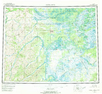
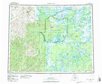
1955 Map of Kateel River
USGS Topo · Published 1969About this map
The Koyukuk River and its intricate network of sloughs and tributaries dominate this mid-century Alaskan landscape. The map highlights the indigenous and commercial activity of the era, centered around Huslia and the Old Cutoff Trading Post. The region's interior relies heavily on water transport and seasonal encampments, as evidenced by Fishing Camp, Richards Camp, and Tobys Cabin. To the west, the Continental Divide creates a sharp topographical contrast to the low-lying wetlands of the Dagitli River basin. Remarkable geological features like the Nogahabara Sand Dunes and Roundabout Mountain provide distinct navigational landmarks in a wilderness defined by shifting watercourses like the Three Day Slough and Racetrack Slough.
Find a feature on this map
81 named features on this map. Tap any name to fly to it.
Don’t see what you’re looking for? This feature index may not catch every label — zoom into the map to look around manually.
Map Details
Editions of this 1955 Kateel River Map
6 editions found

Other maps of this area

1945 · Nulato
USGS Topo · 1:250,000

1948 · Norton Bay
USGS Topo · 1:250,000

1951 · Candle
USGS Topo · 1:250,000

1951 · Selawik
USGS Topo · 1:250,000

1951 · Shungnak
USGS Topo · 1:250,000

1951 · Nulato
USGS Topo · 1:250,000

1951 · Ruby
USGS Topo · 1:250,000

1951 · Norton Bay
USGS Topo · 1:250,000

1951 · Kateel River
USGS Topo · 1:250,000

1951 · Hughes
USGS Topo · 1:250,000