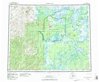
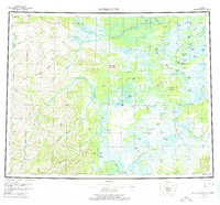
1955 Map of Kateel River
USGS Topo · Published 1984About this map
The Koyukuk River winds through a complex network of sloughs and lakes, anchoring a region defined by its reliance on seasonal waterways and subsistence landmarks. Centered on the settlement of Huslia, this mid-century landscape is marked by remote outposts such as Tobys Cabin, Chips Cabin, and Vincents Camp. The map documents a way of life tied to the river, featuring labels for the Old Cutoff Trading Post and various fishing camps.
Find a feature on this map
81 named features on this map. Tap any name to fly to it.
Don’t see what you’re looking for? This feature index may not catch every label — zoom into the map to look around manually.
Map Details
Editions of this 1955 Kateel River Map
6 editions found

Other maps of this area

1945 · Nulato
USGS Topo · 1:250,000

1948 · Norton Bay
USGS Topo · 1:250,000

1951 · Candle
USGS Topo · 1:250,000

1951 · Selawik
USGS Topo · 1:250,000

1951 · Shungnak
USGS Topo · 1:250,000

1951 · Nulato
USGS Topo · 1:250,000

1951 · Ruby
USGS Topo · 1:250,000

1951 · Norton Bay
USGS Topo · 1:250,000

1951 · Kateel River
USGS Topo · 1:250,000

1951 · Hughes
USGS Topo · 1:250,000