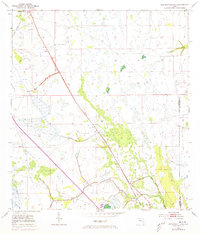
1953 Map of Kenansville SW
USGS Topo · Published 1973About this map
Kenansville and Lokosee anchor this marshy section of the Florida interior during a period of significant infrastructure transformation. The landscape is defined by the diagonal transit of Floridas Turnpike, which cuts across a terrain characterized by wetlands and drainage features like the Spoil Bank system. To the east, the Old Railroad Grade follows the boundary of Osceola and Indian River counties, marking the path of former rail commerce that once supported the local timber or cattle industries. Waterways such as Sixmile Creek and Blue Cypress Creek meander through the sawgrass and cypress strands, while a solitary Landing Strip provides a point of aerial access to this specialized environment. The 1972 revisions, indicated in purple, show the modernization of the road network against the older, established survey lines of the early 1950s.
Find a feature on this map
9 named features on this map. Tap any name to fly to it.
Don’t see what you’re looking for? This feature index may not catch every label — zoom into the map to look around manually.
Map Details
Editions of this 1953 Kenansville SW Map
2 editions found
Other maps of this area

1953 · Fort Kissimmee NE
USGS Topo · 1:24,000

1953 · Lake Marian SE
USGS Topo · 1:24,000

1953 · Fort Drum NW
USGS Topo · 1:24,000

1953 · Kenansville SW
USGS Topo · 1:24,000

1953 · Kenansville
USGS Topo · 1:24,000

1953 · Fort Drum NE
USGS Topo · 1:24,000

1953 · Kenansville NE
USGS Topo · 1:24,000

1953 · Kenansville SE
USGS Topo · 1:24,000

1953 · Lake Marian NE
USGS Topo · 1:24,000

1956 · Fort Pierce
USGS Topo · 1:250,000