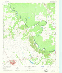
1961 Map of Kerens
USGS Topo · Published 1970About this map
The town of Kerens serves as a central hub in this survey, defined by the St Louis Southwestern railroad and a grid of residential blocks at the intersection of state routes. The landscape transitions from the developed town center to the meandering bends of the Trinity River, which forms the border between Navarro and Henderson counties. This riparian corridor is marked by numerous oxbow lakes and water bodies like Singletary Lake, Round Lake, and Horseshoe Bend, illustrating the shifting path of the river over time.
Find a feature on this map
26 named features on this map. Tap any name to fly to it.
Don’t see what you’re looking for? This feature index may not catch every label — zoom into the map to look around manually.
Map Details
Editions of this 1961 Kerens Map

Other maps of this area

1920 · Kemp
USGS Topo · 1:62,500

1954 · Dallas
USGS Topo · 1:250,000

1957 · Kemp
USGS Topo · 1:62,500

1958 · Dallas
USGS Topo · 1:250,000

1959 · Powell
USGS Topo · 1:24,000

1960 · Tool
USGS Topo · 1:24,000

1960 · Mabank
USGS Topo · 1:24,000

1960 · Creslenn Ranch
USGS Topo · 1:24,000

1960 · Goodlow Park
USGS Topo · 1:24,000

1960 · Malakoff
USGS Topo · 1:24,000