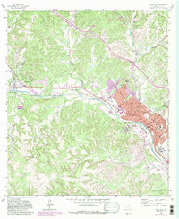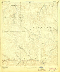
1894 Map of Kerrville
USGS Topo · Published 1904About this map
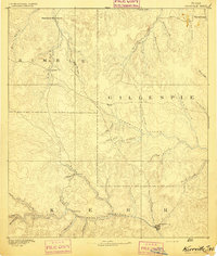
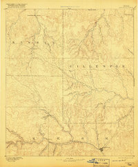
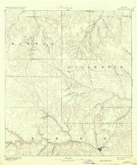
Kerrville serves as the primary hub on this late 19th-century survey, situated along the upper reaches of the Guadalupe River. The landscape is defined by the headwaters of several major Texas river systems, including the Pedernales River which cuts through the central portion of the map near Harper. The drainage patterns of the Edwards Plateau are strikingly detailed, with numerous creeks such as Threadgill Creek, Live Oak Creek, and Wolf Creek carving through the limestone terrain. Smaller pioneer-era outposts like Noxville in Kimble County and Japonica provide essential landmarks for genealogists tracing early Hill Country families. Notable topographic landmarks include Steamboat Mountain in the northwest, overlooking the Fall Creek and White Oak Creek watersheds. This period of the frontier shows a network of trails and early settlements like Ingram and Resort before the extensive modernization of the 20th century, capturing the area's transition into a stable ranching and transport corridor.
Find a feature on this map
40 named features on this map. Tap any name to fly to it.
Don’t see what you’re looking for? This feature index may not catch every label — zoom into the map to look around manually.
Map Details
Editions of this 1894 Kerrville Map
4 editions found
Historical Maps of Kerrville Through Time
8 maps found