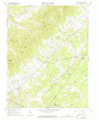
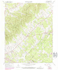
1964 Map of Keswick
USGS Topo · Published 1973About this map
The Southwestern Mountains dominate this central Virginia landscape, creating a dramatic corridor of peaks including Broadhead Mtn and Lonesome Mtn. In the valleys below, a network of historic settlements and ecclesiastical sites dot the countryside, connected by the Chesapeake and Ohio railroad line. Civil and social life in the 1960s was centered around long-standing communities like Cismont, Cobham, and Keswick, each identified with their own local landmarks such as Walkers Parish Ch and South Plains Ch.
Find a feature on this map
51 named features on this map. Tap any name to fly to it.
Don’t see what you’re looking for? This feature index may not catch every label — zoom into the map to look around manually.
Map Details
Editions of this 1964 Keswick Map
5 editions found
Other maps of this area

1891 · Palmyra
USGS Topo · 1:125,000

1892 · Gordonsville
USGS Topo · 1:125,000

1895 · Palmyra
USGS Topo · 1:125,000

1897 · Palmyra
USGS Topo · 1:125,000

1935 · Charlottesville
USGS Topo · 1:62,500

1939 · Charlottesville
USGS Topo · 1:62,500

1943 · Scottsville
USGS Topo · 1:62,500

1946 · Scottsville
USGS Topo · 1:62,500

1947 · Roanoke
USGS Topo · 1:250,000

1949 · Charlottesville
USGS Topo · 1:250,000