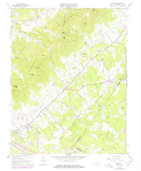
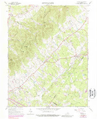
1964 Map of Keswick
USGS Topo · Published 1978About this map
The Southwest Mountains anchor this 1960s landscape, forming a prominent ridge line that separates the rolling Piedmont lowlands. Settlements like Keswick, Cismont, and Cobham follow the lower elevations and the path of the Chesapeake and Ohio railroad. This survey captures a rural Virginia landscape defined by established parish life and family landholdings, evidenced by the numerous named churches and family cemeteries throughout the area.
Find a feature on this map
45 named features on this map. Tap any name to fly to it.
Don’t see what you’re looking for? This feature index may not catch every label — zoom into the map to look around manually.
Map Details
Editions of this 1964 Keswick Map
5 editions found
Other maps of this area

1891 · Palmyra
USGS Topo · 1:125,000

1892 · Gordonsville
USGS Topo · 1:125,000

1895 · Palmyra
USGS Topo · 1:125,000

1897 · Palmyra
USGS Topo · 1:125,000

1935 · Charlottesville
USGS Topo · 1:62,500

1939 · Charlottesville
USGS Topo · 1:62,500

1943 · Scottsville
USGS Topo · 1:62,500

1946 · Scottsville
USGS Topo · 1:62,500

1947 · Roanoke
USGS Topo · 1:250,000

1949 · Charlottesville
USGS Topo · 1:250,000