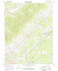
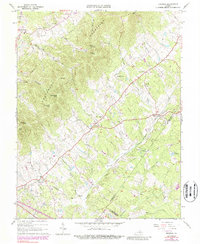
1964 Map of Keswick
USGS Topo · Published 1985About this map
The Southwest Mountains anchor this landscape of Albemarle County, where agricultural valleys and prominent peaks like Walnut Mtn and Broadhead Mtn define the local geography. The Chesapeake and Ohio railroad corridor provides a central transportation spine, linking settlements such as Keswick, Cismont, and Cobham. This mid-century view captures a community deeply rooted in its local institutions, evidenced by the high concentration of rural sanctuaries including Walkers Parish Ch, Piedmont Ch, and St Andrews Chapel. Along the western slopes, familial ties are etched into the land at the Shackelford Cem, while drainage systems like Mechunk Creek and Turkey Run weave through the lowlands. The presence of a Quarry near Peters Mtn and a Water Tank near the rail line suggests a mix of local industry and infrastructure supporting the small hamlets and large estates characteristic of this region.
Find a feature on this map
48 named features on this map. Tap any name to fly to it.
Don’t see what you’re looking for? This feature index may not catch every label — zoom into the map to look around manually.
Map Details
Editions of this 1964 Keswick Map
5 editions found
Other maps of this area

1891 · Palmyra
USGS Topo · 1:125,000

1892 · Gordonsville
USGS Topo · 1:125,000

1895 · Palmyra
USGS Topo · 1:125,000

1897 · Palmyra
USGS Topo · 1:125,000

1935 · Charlottesville
USGS Topo · 1:62,500

1939 · Charlottesville
USGS Topo · 1:62,500

1943 · Scottsville
USGS Topo · 1:62,500

1946 · Scottsville
USGS Topo · 1:62,500

1947 · Roanoke
USGS Topo · 1:250,000

1949 · Charlottesville
USGS Topo · 1:250,000