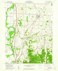
1961 Map of Kingston
USGS Topo · Published 1962About this map
The Scioto River carves a broad valley through Ross and Pickaway counties, anchoring a landscape where agricultural plains meet the rising foothills of Sugarloaf and Bald Hill. In the early 1960s, this region was a critical corridor for transport and industry, evidenced by the dual presence of the Norfolk and Western and Chesapeake and Ohio railroads. Small communities like Kingston and Kinnikinnick serve as local hubs, while smaller crossroads like Delano and Hallsville are connected by a network of family-named roads such as Kellenberger Road and Jadwin Road. Cultural life is visible through numerous rural landmarks, from the Drive-in Theater near the river to local congregations at Crouse Chapel and Bethel Chapel. The presence of the Mound City Group National Monument in the southwest corner highlights the area's ancient human history within the modern farming landscape.
Find a feature on this map
56 named features on this map. Tap any name to fly to it.
Don’t see what you’re looking for? This feature index may not catch every label — zoom into the map to look around manually.
Map Details
Editions of this 1961 Kingston Map
4 editions found
Other maps of this area

1906 · Chillicothe
USGS Topo · 1:62,500

1908 · Chillicothe
USGS Topo · 1:62,500

1911 · Era
USGS Topo · 1:62,500

1912 · Roxabell
USGS Topo · 1:62,500

1913 · Era
USGS Topo · 1:62,500

1914 · Roxabell
USGS Topo · 1:62,500

1914 · Circleville
USGS Topo · 1:62,500

1943 · Era
USGS Topo · 1:62,500

1943 · Circleville
USGS Topo · 1:62,500

1944 · Roxabell
USGS Topo · 1:62,500