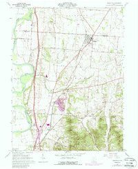
1961 Map of Kingston
USGS Topo · Published 1988About this map
Kingston stands at the convergence of rail and road transport on the boundary between Pickaway and Ross Counties. By the early 1960s, this landscape was defined by its agricultural roots and the infrastructure of the mid-century, including the Norfolk and Western and Chesapeake and Ohio railroads. The map records several smaller settlements and local landmarks like Metzger, Hopetown, and the Drive-in Theater near the Scioto River.
Find a feature on this map
50 named features on this map. Tap any name to fly to it.
Don’t see what you’re looking for? This feature index may not catch every label — zoom into the map to look around manually.
Map Details
Editions of this 1961 Kingston Map
4 editions found
Other maps of this area

1906 · Chillicothe
USGS Topo · 1:62,500

1908 · Chillicothe
USGS Topo · 1:62,500

1911 · Era
USGS Topo · 1:62,500

1912 · Roxabell
USGS Topo · 1:62,500

1913 · Era
USGS Topo · 1:62,500

1914 · Roxabell
USGS Topo · 1:62,500

1914 · Circleville
USGS Topo · 1:62,500

1943 · Era
USGS Topo · 1:62,500

1943 · Circleville
USGS Topo · 1:62,500

1944 · Roxabell
USGS Topo · 1:62,500