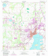
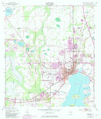
1953 Map of Kissimmee
USGS Topo · Published 1987About this map
The town of Kissimmee anchors this mid-century landscape along the northern shores of Lake Tohopekaliga, showing a community defined by its proximity to both the water and the CSX rail line. The map captures the area during its transition from a primarily agrarian and lakeside hub into a growing suburb, with the Kissimmee Municipal Airport and Floridas Turnpike signaling the increasing importance of modern transportation infrastructure. Cultural and civic landmarks such as the Courthouse, Bryan School, and Osceola High School are clustered in the heart of town.
Find a feature on this map
33 named features on this map. Tap any name to fly to it.
Don’t see what you’re looking for? This feature index may not catch every label — zoom into the map to look around manually.
Map Details
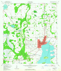
Editions of this 1953 Kissimmee Map
6 editions found
Other maps of this area

1953 · Lake Jessamine
USGS Topo · 1:24,000

1953 · St Cloud North
USGS Topo · 1:24,000

1953 · St Cloud South
USGS Topo · 1:24,000

1953 · Lake Tohopekaliga
USGS Topo · 1:24,000

1953 · Pine Castle
USGS Topo · 1:24,000

1953 · Kissimmee
USGS Topo · 1:24,000

1953 · Windermere
USGS Topo · 1:24,000

1953 · Intercession City
USGS Topo · 1:24,000

1953 · Davenport
USGS Topo · 1:24,000

1955 · Orlando
USGS Topo · 1:250,000