
1936 Map of La Feria
USGS Topo · Published 1936About this map
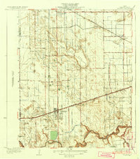
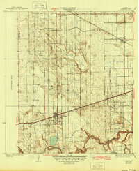
Arroyo Colorado winds through the southern reaches of this landscape, its serpentine path defining the drainage patterns of the lower Rio Grande Valley. In the mid-1930s, the region was characterized by its early irrigation infrastructure and agricultural development, visible in the extensive network of local thoroughfares like Orange Grove Road and Rabb Road. The town of La Feria sits as a primary transit hub where the Missouri Pacific railroad intersects the local grid. Further north, the dry Tiocano Lake Bed serves as a prominent landmark amongst the emerging citrus groves and truck farms. Other small rail-stop communities and settlements such as Bixby, Chasladd, and Stuart Place dot the corridor, illustrating the concentrated growth along the rail lines while the northern boundary at Santa Rosa shows the transition toward more open terrain near the Hidalgo County line.
Find a feature on this map
28 named features on this map. Tap any name to fly to it.
Don’t see what you’re looking for? This feature index may not catch every label — zoom into the map to look around manually.
Map Details
Editions of this 1936 La Feria Map
3 editions found
Other maps of this area

1929 · Harlingen
USGS Topo · 1:24,000

1929 · Santa Rosa
USGS Topo · 1:24,000

1929 · Santa Maria
USGS Topo · 1:24,000

1929 · La Feria
USGS Topo · 1:24,000

1929 · La Paloma
USGS Topo · 1:24,000

1932 · Combes
USGS Topo · 1:31,680

1932 · Harlingen
USGS Topo · 1:31,680

1933 · Santa Rosa
USGS Topo · 1:31,680

1936 · Santa Maria
USGS Topo · 1:31,680
1936 · La Paloma
USGS Topo · 1:31,680