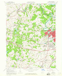
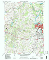
1964 Map of Latrobe
USGS Topo · Published 1965About this map
Loyalhanna Creek meanders through this Westmoreland County landscape in the mid-1960s, a period where the region's industrial character is clearly defined by numerous Strip Mines and the infrastructure of the Pennsylvania Railroad. The city of Latrobe serves as a dense urban anchor, while the surrounding hills are dotted with coal-patch towns and institutional landmarks like St Vincent College and the St Xavier Academy.
Find a feature on this map
75 named features on this map. Tap any name to fly to it.
Don’t see what you’re looking for? This feature index may not catch every label — zoom into the map to look around manually.
Map Details
Editions of this 1964 Latrobe Map
5 editions found
Other maps of this area

1900 · Latrobe
USGS Topo · 1:62,500

1902 · Latrobe
USGS Topo · 1:62,500

1902 · Connellsville
USGS Topo · 1:62,500

1903 · Latrobe
USGS Topo · 1:62,500

1904 · Greensburg
USGS Topo · 1:62,500

1906 · Greensburg
USGS Topo · 1:62,500

1922 · Donegal
USGS Topo · 1:62,500

1931 · Connellsville
USGS Topo · 1:62,500

1935 · Donegal
USGS Topo · 1:62,500

1936 · Connellsville
USGS Topo · 1:62,500