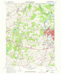
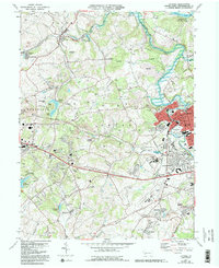
1964 Map of Latrobe
USGS Topo · Published 1973About this map
Industrial and religious landmarks define this landscape in Westmoreland County, dominated by the sprawling institutional grounds of St Vincent College and the Carmelite Monastery. The topographic detail reveals a region transitioning from heavy industry to mid-century development, where active and former extraction sites like the St Vincent Shaft and various Strip Mines sit alongside established communities such as Hannastown and Luxor. The Penn Central railroad corridors weave through the valleys, connecting the concentrated urban center of Latrobe with outlying settlements like Hostetter and Whitney. Notable educational and spiritual centers, including St Xavier Academy and St Joseph Hall High Sch, are prominently featured, while the northern edge of the map is anchored by the recreational waters of Keystone State Park. This record preserves the infrastructure of the early 1960s, from the Latrobe Airport to the intricate network of reservoirs like Jamison Reservoir.
Find a feature on this map
68 named features on this map. Tap any name to fly to it.
Don’t see what you’re looking for? This feature index may not catch every label — zoom into the map to look around manually.
Map Details
Editions of this 1964 Latrobe Map
5 editions found
Other maps of this area

1900 · Latrobe
USGS Topo · 1:62,500

1902 · Latrobe
USGS Topo · 1:62,500

1902 · Connellsville
USGS Topo · 1:62,500

1903 · Latrobe
USGS Topo · 1:62,500

1904 · Greensburg
USGS Topo · 1:62,500

1906 · Greensburg
USGS Topo · 1:62,500

1922 · Donegal
USGS Topo · 1:62,500

1931 · Connellsville
USGS Topo · 1:62,500

1935 · Donegal
USGS Topo · 1:62,500

1936 · Connellsville
USGS Topo · 1:62,500