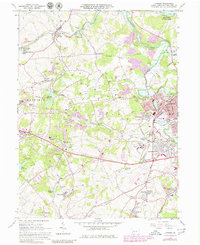
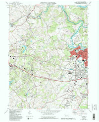
1964 Map of Latrobe
USGS Topo · Published 1979About this map
Latrobe and the surrounding industrial landscape of Westmoreland County appear here in a period of significant post-war transition. The map captures a complex network of Conrail rail lines and extensive Strip Mine operations that define the local economy, particularly near Hostetter and Humphreys. Educational and religious institutions are prominent landmarks, including the sprawling campus of St Vincent College and the Carmelite Monastery, reflecting the area's deep-rooted community identity.
Find a feature on this map
75 named features on this map. Tap any name to fly to it.
Don’t see what you’re looking for? This feature index may not catch every label — zoom into the map to look around manually.
Map Details
Editions of this 1964 Latrobe Map
5 editions found
Other maps of this area

1900 · Latrobe
USGS Topo · 1:62,500

1902 · Latrobe
USGS Topo · 1:62,500

1902 · Connellsville
USGS Topo · 1:62,500

1903 · Latrobe
USGS Topo · 1:62,500

1904 · Greensburg
USGS Topo · 1:62,500

1906 · Greensburg
USGS Topo · 1:62,500

1922 · Donegal
USGS Topo · 1:62,500

1931 · Connellsville
USGS Topo · 1:62,500

1935 · Donegal
USGS Topo · 1:62,500

1936 · Connellsville
USGS Topo · 1:62,500
Featured Places
- Latrobe, PA
- Loyalhanna, Derry Township
- Carney, Unity Township
- Sowash, Unity Township
- Lawson Heights, Unity Township