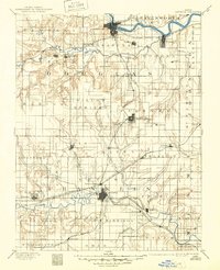
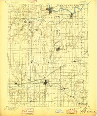
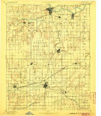
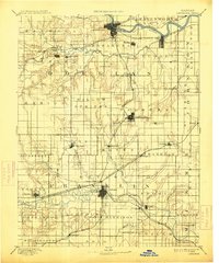
1889 Map of Lawrence
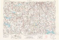
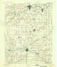
USGS Topo · Published 1949About this map
Lawrence and Ottawa anchor this late nineteenth-century survey of the eastern Kansas river valleys, where the Kansas River and Marais des Cygnes River carve across the prairie landscape. The area is defined by a dense network of early steam transportation, including the Atchison Topeka and Santa Fe Railroad and the Union Pacific Railroad through North Lawrence. Away from the main hubs, small agricultural settlements like Vinland, Hesper, and Clinton are established among the drainages of Wakarusa Creek and Eight Mile Creek. Distinctive landmarks such as Blue Mound and the Three Sisters rise above the township grids of Palmyra and Wakarusa. This reconnaissance-level mapping preserves the locations of early rural centers like Prairie City and Black Jack, many of which were central to the state's formative development years before modern highway expansion.
Find a feature on this map
85 named features on this map. Tap any name to fly to it.
Don’t see what you’re looking for? This feature index may not catch every label — zoom into the map to look around manually.
Map Details
Editions of this 1889 Lawrence Map
6 editions found

Historical Maps of Lawrence Through Time
7 maps found