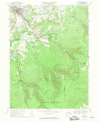
1967 Map of Ligonier
USGS Topo · Published 1971About this map
Ligonier serves as the focal point of this late 1960s landscape, situated where Loyalhanna Creek meets Mill Creek. The map documents a blend of early industrial relics and mid-century recreation, featuring the historic California Furnace alongside modern amenities like the Laurel Valley Golf Club and the Rolling Rock Racecourse. Outside the borough, smaller settlements like Laughlintown and Rector are connected by a network of rural routes, including Freeman Road and the path of the old Forbes Road.
Find a feature on this map
87 named features on this map. Tap any name to fly to it.
Don’t see what you’re looking for? This feature index may not catch every label — zoom into the map to look around manually.
Map Details
Editions of this 1967 Ligonier Map
4 editions found
Other maps of this area

1900 · Latrobe
USGS Topo · 1:62,500

1902 · Latrobe
USGS Topo · 1:62,500

1903 · Latrobe
USGS Topo · 1:62,500

1913 · Somerset
USGS Topo · 1:62,500

1915 · Somerset
USGS Topo · 1:62,500

1920 · New Florence
USGS Topo · 1:62,500

1921 · New Florence
USGS Topo · 1:48,000

1922 · Donegal
USGS Topo · 1:62,500

1922 · New Florence
USGS Topo · 1:62,500

1935 · Donegal
USGS Topo · 1:62,500