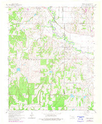
1966 Map of Lindsay SW
USGS Topo · Published 1980About this map
The Washita River meanders through the heart of the Golden Trend oil region, a landscape defined by both agricultural drainage and industrial infrastructure. The settlement of Bradley sits near the northern boundary, while an Old Grade Railroad traces a former path across the river valley. Evidence of the mid-century petroleum economy is prominent, featuring an active Refinery, multiple Pipeline corridors, and supporting landmarks like a Water Tank and Radio Tower. Local history is anchored by family-named landscape features such as Sandy Creek, Larimore Creek, and Rounds Creek. A small Cem and a Hospital further illustrate the community development of this tri-county intersection where Grady, McClain, and Garvin counties meet.
Find a feature on this map
24 named features on this map. Tap any name to fly to it.
Don’t see what you’re looking for? This feature index may not catch every label — zoom into the map to look around manually.
Map Details
Editions of this 1966 Lindsay SW Map
3 editions found
Other maps of this area

1902 · Rush Springs
USGS Topo · 1:125,000

1949 · Rush Springs
USGS Topo · 1:62,500

1950 · Rush Springs
USGS Topo · 1:62,500

1950 · Marlow
USGS Topo · 1:62,500

1951 · Marlow
USGS Topo · 1:62,500

1957 · Ardmore
USGS Topo · 1:250,000

1963 · Ardmore
USGS Topo · 1:250,000

1966 · Lindsay
USGS Topo · 1:24,000
1966 · Criner
USGS Topo · 1:24,000

1966 · Lindsay SW
USGS Topo · 1:24,000