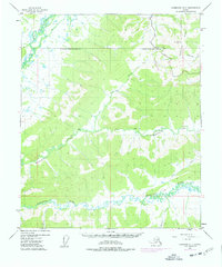
1953 Map of Livengood A-3
USGS Topo · Published 1978About this map
Chatanika River meanders through the southern portion of this landscape, carving a complex path of oxbows and marshy lowlands within the Fairbanks North Star Borough. The map captures a significant moment in the region's infrastructure development, specifically noting The Trans-Alaska Pipeline (Under Construction) as it traverses the interior. This industrial corridor runs parallel to sections of the Elliott Highway, which winds past Wickersham Dome and provides the primary overland access through these hills.
Find a feature on this map
17 named features on this map. Tap any name to fly to it.
Don’t see what you’re looking for? This feature index may not catch every label — zoom into the map to look around manually.
Map Details
Editions of this 1953 Livengood A-3 Map
4 editions found

Other maps of this area

1945 · Livengood
USGS Topo · 1:250,000

1949 · Fairbanks D-2
USGS Topo · 1:62,500

1949 · Fairbanks D-3
USGS Topo · 1:63,360

1949 · Fairbanks D-4
USGS Topo · 1:63,360

1950 · Fairbanks
USGS Topo · 1:250,000

1950 · Fairbanks D-3
USGS Topo · 1:63,360

1951 · Fairbanks
USGS Topo · 1:250,000

1951 · Livengood
USGS Topo · 1:250,000

1951 · Livengood B-2
USGS Topo · 1:63,360

1951 · Livengood A-4
USGS Topo · 1:63,360