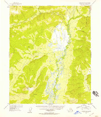
1953 Map of Livengood B-4
USGS Topo · Published 1957About this map
The Tolovana River meanders through the heart of this interior Alaska territory, creating a broad, marshy valley flanked by significant elevations like Hot Springs Dome. This early 1950s survey documents a landscape defined by logistical transit and mineral extraction. The presence of Mine Tailings near Livengood Creek in the northeast corner points to the area's gold mining heritage, while the Elliott Highway provides the primary overland connection toward Fairbanks.
Find a feature on this map
16 named features on this map. Tap any name to fly to it.
Don’t see what you’re looking for? This feature index may not catch every label — zoom into the map to look around manually.
Map Details
Editions of this 1953 Livengood B-4 Map
3 editions found
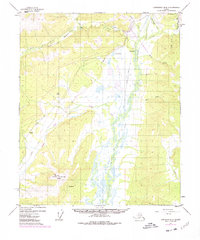
Other maps of this area

1945 · Livengood
USGS Topo · 1:250,000

1951 · Livengood
USGS Topo · 1:250,000

1951 · Livengood A-5
USGS Topo · 1:63,360

1951 · Livengood A-4
USGS Topo · 1:63,360

1952 · Livengood C-5
USGS Topo · 1:63,360

1952 · Livengood B-5
USGS Topo · 1:63,360

1952 · Livengood C-4
USGS Topo · 1:63,360

1953 · Livengood B-4
USGS Topo · 1:63,360

1953 · Livengood A-4
USGS Topo · 1:63,360

1953 · Livengood A-3
USGS Topo · 1:63,360