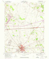
1961 Map of London
USGS Topo · Published 1974About this map
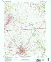
London Correctional Institution dominates the southwestern landscape of this Madison County map, surrounded by the extensive farmland of Union and Somerford townships. The map documents a period of mid-century infrastructure growth, evidenced by the Penn Central rail lines and the prominent Madison County Airport north of the city. The city of London serves as the central hub, containing critical civic institutions like the Courthouse, County Hospital, and County Fairgrounds.
Find a feature on this map
50 named features on this map. Tap any name to fly to it.
Don’t see what you’re looking for? This feature index may not catch every label — zoom into the map to look around manually.
Map Details
Editions of this 1961 London Map
5 editions found
Other maps of this area

1907 · London
USGS Topo · 1:62,500

1907 · South Charleston
USGS Topo · 1:62,500

1914 · Mechanicsburg
USGS Topo · 1:62,500

1916 · Mechanicsburg
USGS Topo · 1:62,500

1916 · Milford Center
USGS Topo · 1:62,500

1944 · Mechanicsburg
USGS Topo · 1:62,500

1944 · Milford Center
USGS Topo · 1:62,500

1947 · Columbus
USGS Topo · 1:250,000

1950 · Marion
USGS Topo · 1:250,000

1961 · Columbus
USGS Topo · 1:250,000