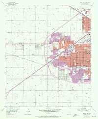
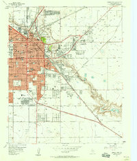
1957 Map of Lubbock West
USGS Topo · Published 1971About this map
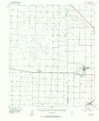
The western expansion of Lubbock is documented here through a layering of data from 1957 and revisions from 1970. The transition from the rural High Plains landscape to a dense urban grid is anchored by Texas Technological College and the growing campus of Lubbock Christian College. The infrastructure of the era is defined by the Atchison Topeka and Santa Fe railroad corridor and the Levelland Highway, which facilitated the development of outlying communities like Carlisle and West End Place.
Find a feature on this map
50 named features on this map. Tap any name to fly to it.
Don’t see what you’re looking for? This feature index may not catch every label — zoom into the map to look around manually.
Map Details
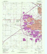
Editions of this 1957 Lubbock West Map
3 editions found
Other maps of this area

1954 · Lubbock
USGS Topo · 1:250,000

1954 · Brownfield
USGS Topo · 1:250,000
1956 · Shallowater
USGS Topo · 1:24,000
1956 · New Deal
USGS Topo · 1:24,000
1957 · Lubbock East
USGS Topo · 1:24,000
1957 · New Home
USGS Topo · 1:62,500
1957 · Lubbock West
USGS Topo · 1:24,000

1957 · Lubbock
USGS Topo · 1:62,500
1957 · Meadow
USGS Topo · 1:62,500
1957 · Wolfforth
USGS Topo · 1:62,500