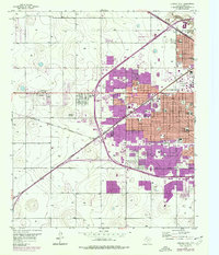
1957 Map of Lubbock West
USGS Topo · Published 1977About this map
Texas Technological University and the expanding suburbs of western Lubbock define this mid-century landscape. The map illustrates a period of significant growth, with the city limits pushing westward toward Carlisle and West End Place. This expansion is highlighted by the purple-tinted urban extensions that contrast with the more traditional residential grids of the central city. Educational institutions like Lubbock Christian College and numerous local schools, including Monterey High Sch and Hutchinson Jr High Sch, signal the development of established neighborhoods during this era.
Find a feature on this map
47 named features on this map. Tap any name to fly to it.
Don’t see what you’re looking for? This feature index may not catch every label — zoom into the map to look around manually.
Map Details
Editions of this 1957 Lubbock West Map
3 editions found
Other maps of this area

1954 · Lubbock
USGS Topo · 1:250,000

1954 · Brownfield
USGS Topo · 1:250,000

1956 · Shallowater
USGS Topo · 1:24,000

1956 · New Deal
USGS Topo · 1:24,000

1957 · Lubbock East
USGS Topo · 1:24,000

1957 · New Home
USGS Topo · 1:62,500

1957 · Lubbock West
USGS Topo · 1:24,000

1957 · Lubbock
USGS Topo · 1:62,500

1957 · Meadow
USGS Topo · 1:62,500

1957 · Wolfforth
USGS Topo · 1:62,500