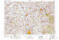
1966 Map of Marion
USGS Topo · Published 1976About this map
The Scioto River and Sandusky River drainages anchor this mid-1960s survey, revealing the industrial and institutional landscape of Central Ohio. Large-scale public works and facilities characterize the era, including the Ohio State Reformatory near Mansfield and the Marion Correctional Institution. The expansion of the Columbus metropolitan area is evident through the suburban growth of Upper Arlington, Worthington, and Westerville, while the northern reaches maintain a network of smaller agricultural hubs like Bucyrus and Upper Sandusky.
Find a feature on this map
367 named features on this map. Tap any name to fly to it.
Don’t see what you’re looking for? This feature index may not catch every label — zoom into the map to look around manually.
Map Details
Editions of this 1966 Marion Map
3 editions found

Other maps of this area

1901 · Dublin
USGS Topo · 1:62,500

1901 · Fostoria
USGS Topo · 1:62,500

1901 · Wooster
USGS Topo · 1:62,500

1902 · Westerville
USGS Topo · 1:62,500

1903 · Wooster
USGS Topo · 1:62,500

1903 · Dublin
USGS Topo · 1:62,500

1903 · Fostoria
USGS Topo · 1:62,500

1903 · Findlay
USGS Topo · 1:62,500

1903 · Marion
USGS Topo · 1:62,500

1904 · Westerville
USGS Topo · 1:62,500