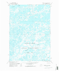
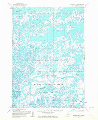
1953 Map of Marshall B-8
USGS Topo · Published 1983About this map
The Clarence Rhode National Wildlife Range Area No 1 dominates this landscape, showing the vast and intricate wetlands of the Yukon-Kuskokwim Delta as they were surveyed in the early 1950s. This territory is defined by an incredibly dense network of ponds, lakes, and marshes, illustrating a classic subarctic tundra environment where land and water are constantly intertwined. The Kashunuk River meanders across the northern portion of the quadrangle, while the Manokinak River and Azun River carve winding paths through the southern reaches. An Indefinite Boundary runs through the central region, reflecting the challenges of precise mapping in such a dynamic, water-heavy terrain. Based on aerial photography by the Army Map Service, this survey captures the raw geography of the delta before modern environmental shifts, serving as a primary record of the region's complex hydrology and protected wilderness areas.
Find a feature on this map
5 named features on this map. Tap any name to fly to it.
Don’t see what you’re looking for? This feature index may not catch every label — zoom into the map to look around manually.
Map Details
Editions of this 1953 Marshall B-8 Map
2 editions found
Other maps of this area

1951 · Marshall
USGS Topo · 1:250,000

1951 · Hooper Bay
USGS Topo · 1:250,000

1952 · Marshall C-7
USGS Topo · 1:63,360
1952 · Marshall C-8
USGS Topo · 1:63,360
1952 · Hooper Bay C-1
USGS Topo · 1:63,360

1953 · Hooper Bay
USGS Topo · 1:250,000
1953 · Hooper Bay B-1
USGS Topo · 1:63,360
1953 · Marshall B-8
USGS Topo · 1:63,360

1953 · Marshall B-7
USGS Topo · 1:63,360
1954 · Marshall A-8
USGS Topo · 1:63,360