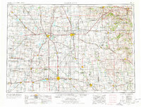
1954 Map of Mason City
USGS Topo · Published 1978About this map
The Winnebago River and Shell Rock River valleys define this mid-century landscape, anchoring a regional network of agriculture and transport across Northern Iowa and Southern Minnesota. This mid-1970s revision highlights a dense cluster of recreation and conservation areas, including McIntosh Woods St Pk and Clear Lake St Pk on the shores of Clear Lake. The map details the transition from the rolling terrain near Pilot Mound to the prairie expanses preserved at Hayden Prairie State Park.
Find a feature on this map
204 named features on this map. Tap any name to fly to it.
Don’t see what you’re looking for? This feature index may not catch every label — zoom into the map to look around manually.
Map Details
Editions of this 1954 Mason City Map
2 editions found

Other maps of this area

1901 · Oelwein
USGS Topo · 1:125,000

1906 · Decorah
USGS Topo · 1:125,000

1932 · Cochrane
USGS Topo · 1:62,500

1934 · Plainview
USGS Topo · 1:62,500

1934 · Cochrane
USGS Topo · 1:62,500

1935 · Rochester
USGS Topo · 1:48,000

1937 · Cochrane
USGS Topo · 1:62,500

1938 · Plainview
USGS Topo · 1:62,500

1939 · Rochester
USGS Topo · 1:62,500

1950 · Mankato East
USGS Topo · 1:62,500