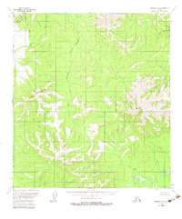
1954 Map of Medfra B-6
USGS Topo · Published 1983About this map
Fossil Mountain and Page Mountain anchor this interior Alaskan landscape, which was photogrammetrically mapped in the mid-1950s. The region is defined by a complex drainage system where the Susulatna River and its tributary, the Agate Fork, cut through the terrain. To the north, the Cripple Creek Mountains rise above Cripple Creek and Butte Creek. The map captures a wilderness area devoid of established roads or trails during the survey period, reflecting the raw state of the Yukon-Koyukuk region before modern development. Detailed topographic contours illustrate the sharp relief of a Canyon and the headwaters of the West Fork Nixon Fork, providing a foundational record of the area's natural geography under the Kateel River Meridian.
Find a feature on this map
9 named features on this map. Tap any name to fly to it.
Don’t see what you’re looking for? This feature index may not catch every label — zoom into the map to look around manually.
Map Details
Editions of this 1954 Medfra B-6 Map
3 editions found
Other maps of this area

1950 · Medfra
USGS Topo · 1:250,000

1951 · Ophir
USGS Topo · 1:250,000

1953 · Medfra B-5
USGS Topo · 1:63,360

1954 · Medfra A-6
USGS Topo · 1:63,360

1954 · Medfra A-5
USGS Topo · 1:63,360

1954 · Ophir A-1
USGS Topo · 1:63,360

1954 · Medfra C-6
USGS Topo · 1:63,360

1954 · Medfra C-5
USGS Topo · 1:63,360

1954 · Medfra B-6
USGS Topo · 1:63,360

1954 · Ophir C-1
USGS Topo · 1:63,360