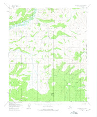
1956 Map of Melozitna B-1
USGS Topo · Published 1975About this map
Little Melozitna Hot Springs stands as a notable landmark in the northern reaches of this Alaskan interior landscape, situated along the Melozitna River. The area is defined by a dense network of drainages including Hot Springs Creek, Moran Creek, and Eureka Creek, which flow through the upland terrain. To the south, Mason Mountain rises above the valley, marked by the remote settlement of Switchback on its slopes.
Find a feature on this map
26 named features on this map. Tap any name to fly to it.
Don’t see what you’re looking for? This feature index may not catch every label — zoom into the map to look around manually.
Map Details
Editions of this 1956 Melozitna B-1 Map
3 editions found
Other maps of this area

1951 · Melozitna
USGS Topo · 1:250,000

1951 · Tanana
USGS Topo · 1:250,000

1952 · Melozitna A-2
USGS Topo · 1:63,360

1952 · Tanana A-6
USGS Topo · 1:63,360

1952 · Melozitna A-1
USGS Topo · 1:63,360

1953 · Melozitna A-2
USGS Topo · 1:63,360

1956 · Melozitna B-2
USGS Topo · 1:63,360

1956 · Melozitna C-1
USGS Topo · 1:63,360

1956 · Melozitna B-1
USGS Topo · 1:63,360
1956 · Melozitna C-2
USGS Topo · 1:63,360