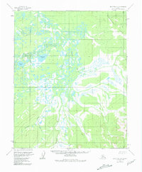
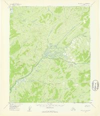
1954 Map of Melozitna C-5
USGS Topo · Published 1981About this map
The Nayuka River meanders through this interior Alaskan wilderness, as documented by aerial photography from the early 1950s. This survey records a landscape dominated by complex hydrological networks, where the river and its tributary Telukhti Creek snake through countless nameless ponds and wetlands. Two significant water bodies, Klymunget Lake and Besivivit Lake, provide clear geographical anchors in a terrain otherwise defined by shifting drainage patterns. To the northeast, the elevation rises into the Takha Khdona Hills, offering a stark contrast to the low-lying basin. The map illustrates a region void of man-made infrastructure, reflecting the area's state before late-twentieth-century developments, focusing entirely on the natural topography and the intricate relationship between the tundra and its waterways.
Find a feature on this map
6 named features on this map. Tap any name to fly to it.
Don’t see what you’re looking for? This feature index may not catch every label — zoom into the map to look around manually.
Map Details
Editions of this 1954 Melozitna C-5 Map
3 editions found
Other maps of this area

1951 · Melozitna
USGS Topo · 1:250,000

1954 · Melozitna C-4
USGS Topo · 1:63,360
1954 · Melozitna B-4
USGS Topo · 1:63,360

1954 · Melozitna C-5
USGS Topo · 1:63,360

1954 · Melozitna C-6
USGS Topo · 1:63,360

1954 · Melozitna D-5
USGS Topo · 1:63,360
1954 · Melozitna B-5
USGS Topo · 1:63,360

1954 · Melozitna D-4
USGS Topo · 1:63,360

1954 · Melozitna D-6
USGS Topo · 1:63,360
1954 · Melozitna B-6
USGS Topo · 1:63,360