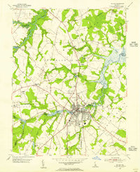
1954 Map of Milford
USGS Topo · Published 1955About this map
Milford serves as the focal point of this 1954 survey, straddling the boundary between Kent and Sussex counties. The landscape is defined by its complex hydrology, where the Mispillion River and Murderkill River weave through low-lying necks of land toward the Delaware Bay. The town's industrial and transportation roots are clearly visible through the alignment of the Pennsylvania Railroad and the concentration of millponds like Silver Lake, Haven Lake, and Marshall Millpond.
Find a feature on this map
53 named features on this map. Tap any name to fly to it.
Don’t see what you’re looking for? This feature index may not catch every label — zoom into the map to look around manually.
Map Details
Editions of this 1954 Milford Map
3 editions found
Other maps of this area

1899 · Vineland
USGS Topo · 1:125,000

1899 · Dover
USGS Topo · 1:125,000

1906 · Dover
USGS Topo · 1:125,000

1918 · Cedar Creek
USGS Topo · 1:62,500

1918 · Harrington
USGS Topo · 1:62,500

1919 · Cedar Creek
USGS Topo · 1:62,500

1919 · Vineland
USGS Topo · 1:125,000

1920 · Dover
USGS Topo · 1:125,000

1926 · Wyoming
USGS Topo · 1:48,000

1930 · Wyoming
USGS Topo · 1:62,500