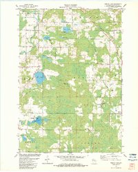
1982 Map of Mission Lake
USGS Topo · Published 1983About this map
Glacial geology and a dense network of inland waters define this portion of Marathon County, where prominent landforms like the Esker near Hilltop overlook a landscape of kettle lakes and wetlands. The eastern edge of the quadrangle is marked by the Chicago and North Western Railroad, which runs parallel to Comet Creek through the settlement of Elderon. Local governance and community life are visible through scattered Townhall locations and the Evergreen Rest Cem.
Find a feature on this map
47 named features on this map. Tap any name to fly to it.
Don’t see what you’re looking for? This feature index may not catch every label — zoom into the map to look around manually.
Map Details
Editions of this 1982 Mission Lake Map
This is the sole edition of this map. No revisions or reprints were ever made.
Other maps of this area

1899 · Wausau
USGS Topo · 1:125,000

1902 · Wausau
USGS Topo · 1:125,000

1953 · Hatley
USGS Topo · 1:48,000

1954 · Wittenberg
USGS Topo · 1:48,000

1955 · Tigerton
USGS Topo · 1:48,000

1955 · Rosholt
USGS Topo · 1:48,000

1955 · Green Bay
USGS Topo · 1:250,000

1964 · Wittenberg
USGS Topo · 1:62,500

1964 · Hatley
USGS Topo · 1:62,500

1969 · Rosholt
USGS Topo · 1:24,000