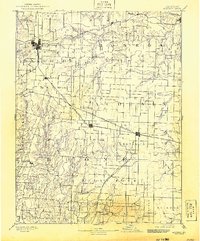
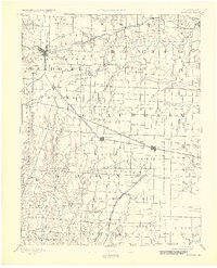
1890 Map of Moberly
USGS Topo · Published 1943About this map
The rail junction at Moberly serves as a primary hub for this late nineteenth-century Missouri landscape, where the iron tracks of the Wabash Railroad and the Missouri Pacific Railroad intersect. This survey, conducted shortly before the turn of the century, details a transition from the rugged drainage systems of the Middle Fork Salt River and Elk Fork Salt River to the emerging agricultural settlements of the prairie.
Find a feature on this map
76 named features on this map. Tap any name to fly to it.
Don’t see what you’re looking for? This feature index may not catch every label — zoom into the map to look around manually.
Map Details
Editions of this 1890 Moberly Map
6 editions found
Other maps of this area

1886 · Jefferson City
USGS Topo · 1:125,000

1888 · Boonville
USGS Topo · 1:125,000

1890 · Mexico
USGS Topo · 1:125,000

1890 · Moberly
USGS Topo · 1:125,000

1890 · Glasgow
USGS Topo · 1:125,000

1890 · Fulton
USGS Topo · 1:125,000

1894 · Jefferson City
USGS Topo · 1:125,000

1903 · Palmyra
USGS Topo · 1:125,000

1908 · Macon
USGS Topo · 1:62,500

1910 · Macon
USGS Topo · 1:62,500