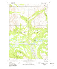
1951 Map of Mount Katmai C-3
USGS Topo · Published 1982About this map
Savonoski River and its glacial tributaries define this stretch of the Alaska Peninsula as it appeared in the mid-20th century. The wide, braided river valley forms a central corridor through the landscape, joined from the south by the Rainbow River. These watercourses dominate a terrain marked by dramatic elevation changes, notably at Wolverine Falls and the survey point VABM 3462 Scrab. Within the Katmai National Park (Wilderness), the map identifies Naukfak (Site), a location indicating human presence or historic habitation in an otherwise unpopulated mountain environment. Water drainage patterns, including Hardscrabble Creek and Gorge Creek, reveal the complex hydrological network typical of this subarctic region before later management changes.
Find a feature on this map
10 named features on this map. Tap any name to fly to it.
Don’t see what you’re looking for? This feature index may not catch every label — zoom into the map to look around manually.
Map Details
Editions of this 1951 Mount Katmai C-3 Map
3 editions found
Other maps of this area

1948 · Mt Katmai
USGS Topo · 1:250,000

1951 · Mt Katmai
USGS Topo · 1:250,000

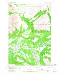
1951 · Mount Katmai C-3
USGS Topo · 1:63,360

1951 · Mount Katmai B-4
USGS Topo · 1:63,360

1951 · Mount Katmai C-4
USGS Topo · 1:63,360

1951 · Mount Katmai C-2
USGS Topo · 1:63,360

1951 · Mount Katmai D-4
USGS Topo · 1:63,360

1951 · Mount Katmai D-2
USGS Topo · 1:63,360

1951 · Mount Katmai D-3
USGS Topo · 1:63,360

1951 · Mount Katmai B-3
USGS Topo · 1:63,360