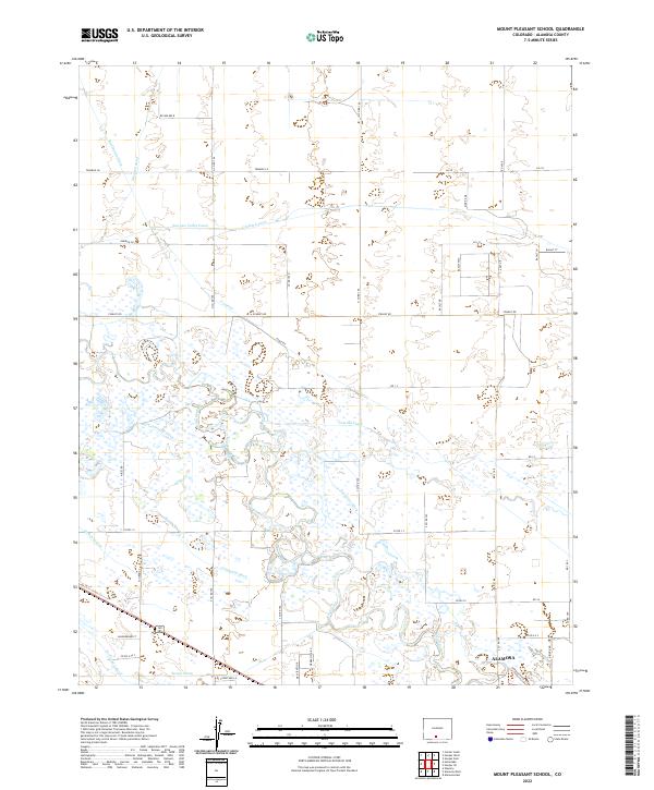
2022 Map of Mount Pleasant School
USGS Topo · Published 2022About this map
Rio Grande waters dominate this San Luis Valley landscape, which is defined by an intricate network of irrigation infrastructure and drainage systems. The map details the complex hydraulic engineering required for high-altitude agriculture, featuring prominent arteries like the San Luis Valley Canal, Lower Centennial Ditch, and Costilla Canal. These waterways crisscross the valley floor, supporting the rural sections north of Alamosa. The settlement of Alamosa itself appears in the southeast corner, where the street grid begins to give way to recreational features like the Simpson Loop Trl. This documentation of the modern water system illustrates the persistent reliance on historic water rights and gravity-fed channels, including the Excelsior Ditch and Centennial Ditch, which remain central to the region's geographic identity and economic life.
Find a feature on this map
37 named features on this map. Tap any name to fly to it.
Don’t see what you’re looking for? This feature index may not catch every label — zoom into the map to look around manually.
Map Details
Editions of this 2022 Mount Pleasant School Map
This is the sole edition of this map. No revisions or reprints were ever made.
Other maps of this area

1915 · Del Norte
USGS Topo · 1:125,000

1917 · Del Norte
USGS Topo · 1:125,000

1922 · Conejos
USGS Topo · 1:125,000

1945 · Durango
USGS Topo · 1:250,000

1953 · Durango
USGS Topo · 1:250,000

1954 · Durango
USGS Topo · 1:250,000

1954 · Trinidad
USGS Topo · 1:250,000

1955 · Trinidad
USGS Topo · 1:250,000

1958 · Trinidad
USGS Topo · 1:250,000

1959 · Trinidad
USGS Topo · 1:250,000