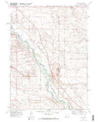
1969 Map of Moxa
USGS Topo · Published 1972About this map
Hams Fork meanders through the high desert of the Green River Basin, defining the water-dependent geography of this 1969 landscape. The area is dominated by an intricate network of irrigation channels, including the Fabian and Tyler Ditch, Moxa Ditch, and the Philbrick and Johnson Ditch, which redirect water from the river to the arid surrounding flats. These ditches, alongside the Union Pacific railroad corridor, illustrate the critical intersection of transportation and water rights in southwestern Wyoming. The small settlement of Moxa serves as a central point along the rail line, flanked by the elevated Chrisman Bench to the northwest. Land use is further characterized by scattered industrial activity, indicated by several Gravel Pits and a prominent pipeline cutting diagonally across the terrain. The boundary between Lincoln and Sweetwater counties also traverses this section, marking a divide in the open rangeland.
Find a feature on this map
15 named features on this map. Tap any name to fly to it.
Don’t see what you’re looking for? This feature index may not catch every label — zoom into the map to look around manually.
Map Details
Editions of this 1969 Moxa Map
2 editions found
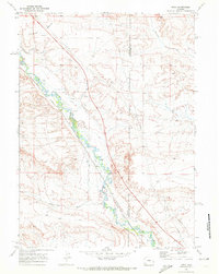
Other maps of this area

1954 · Ogden
USGS Topo · 1:250,000

1954 · Rock Springs
USGS Topo · 1:250,000

1958 · Ogden
USGS Topo · 1:250,000

1958 · Rock Springs
USGS Topo · 1:250,000

1960 · Ogden
USGS Topo · 1:250,000

1961 · Sevenmile Gulch
USGS Topo · 1:24,000

1961 · Granger
USGS Topo · 1:24,000

1962 · Rock Springs
USGS Topo · 1:250,000
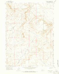
1963 · Whiskey Buttes
USGS Topo · 1:24,000

1969 · Church Butte NW
USGS Topo · 1:24,000