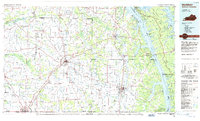
1986 Map of Murray
USGS Topo · Published 1986About this map
The Tennessee River and Cumberland Valley define the eastern edge of this western Kentucky landscape, where the narrow peninsula of Land Between the Lakes separates the massive waters of Kentucky Lake and Lake Barkley. This 1980s-era map shows a region shaped by major hydrology projects and a dense network of inland settlements. The city of Mayfield serves as a central hub for the Illinois Central Gulf RR and the Purchase Parkway, while Murray anchors the southern portion of the sheet near the Kentucky Tennessee border.
Find a feature on this map
139 named features on this map. Tap any name to fly to it.
Don’t see what you’re looking for? This feature index may not catch every label — zoom into the map to look around manually.
Map Details
Editions of this 1986 Murray Map
2 editions found
Other maps of this area

1908 · Princeton
USGS Topo · 1:62,500

1910 · Princeton
USGS Topo · 1:62,500

1926 · Paducah
USGS Topo · 1:62,500

1928 · Eddyville
USGS Topo · 1:48,000

1928 · La Center
USGS Topo · 1:62,500

1929 · Smithland
USGS Topo · 1:62,500

1929 · Paducah
USGS Topo · 1:62,500

1931 · Eddyville
USGS Topo · 1:62,500

1931 · Cairo
USGS Topo · 1:62,500

1932 · La Center
USGS Topo · 1:62,500