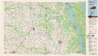
1986 Map of Murray
USGS Topo · Published 1995About this map
Murray State University anchors the southeastern portion of this mid-1980s landscape, positioned as a regional hub for education and commerce in Calloway County. To the west, Mayfield serves as a critical junction for the Illinois Central Gulf Railroad and the Purchase Parkway, illustrating the area's dependence on both rail and highway logistics. The eastern edge is dominated by the massive water bodies of Kentucky Lake and Lake Barkley, separated by the Land Between the Lakes national recreation area. This unique geography, managed by the Tennessee Valley Authority, showcases the mid-century transformation of the Tennessee River valley into a sprawling recreational and hydroelectric corridor. Smaller rural communities like Fancy Farm, Dukedom, and Lynnville are scattered across the interior, connected by a dense network of secondary roads and state highways that bridge the gaps between the larger agricultural centers and the river systems.
Find a feature on this map
209 named features on this map. Tap any name to fly to it.
Don’t see what you’re looking for? This feature index may not catch every label — zoom into the map to look around manually.
Map Details
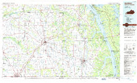
Editions of this 1986 Murray Map
2 editions found
Other maps of this area

1908 · Princeton
USGS Topo · 1:62,500

1910 · Princeton
USGS Topo · 1:62,500

1926 · Paducah
USGS Topo · 1:62,500

1928 · Eddyville
USGS Topo · 1:48,000

1928 · La Center
USGS Topo · 1:62,500

1929 · Smithland
USGS Topo · 1:62,500

1929 · Paducah
USGS Topo · 1:62,500

1931 · Eddyville
USGS Topo · 1:62,500

1931 · Cairo
USGS Topo · 1:62,500

1932 · La Center
USGS Topo · 1:62,500