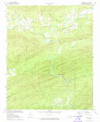
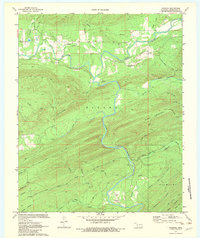
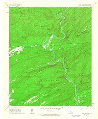
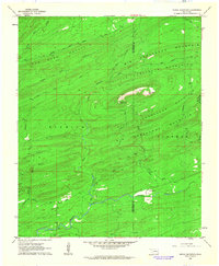
1972 Map of Nashoba
USGS Topo · Published 1973About this map
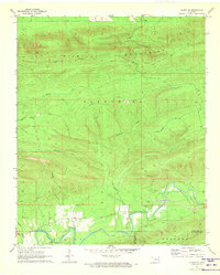
Nashoba and Nolia anchor this Pushmataha County landscape during the early 1970s, a period when the local economy relied on scattered resource extraction and rural agriculture. The topography is defined by the winding course of the Little River and Black Fork, which are surrounded by several industrial Shale Pits and aquaculture operations like the Fish Farm. The terrain rises sharply into named peaks such as Cripple Mtn and Blackjack Mtn, while the presence of the Trails End Camp and a Landing Strip near the river suggests a mix of recreational use and small-scale aviation access. Genealogists will find value in the clearly marked Black Fork Cem and Nolia Cem, providing specific locations for family research in this part of the Kiamichi mountain region.
Find a feature on this map
39 named features on this map. Tap any name to fly to it.
Don’t see what you’re looking for? This feature index may not catch every label — zoom into the map to look around manually.
Map Details
Editions of this 1972 Nashoba Map
2 editions found
Other maps of this area

1901 · Tuskahoma
USGS Topo · 1:125,000

1901 · Alikchi
USGS Topo · 1:125,000

1908 · Tuskahoma
USGS Topo · 1:125,000

1909 · Tuskahoma
USGS Topo · 1:125,000

1950 · Mcalester
USGS Topo · 1:250,000

1962 · McAlester
USGS Topo · 1:250,000
1962 · Caney Mountain
USGS Topo · 1:24,000
1962 · Signal Mountain
USGS Topo · 1:24,000

1965 · McAlester
USGS Topo · 1:250,000
1971 · Albion SE
USGS Topo · 1:24,000