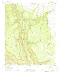
1953 Map of Navajo Peak
USGS Topo · Published 1975About this map
The Rio Chama carves a deep path through the center of this terrain, marking a dramatic geological divide between the high plateaus of the Santa Fe National Forest and Carson National Forest. The landscape is defined by massive formations such as The Hogback and Mesa Golondrina, while human presence is primarily recorded through isolated outposts and historical sites. Of particular interest to archaeologists and historians are the Cliff Dwellings located near the southern confluence with the Rio Gallina.
Find a feature on this map
29 named features on this map. Tap any name to fly to it.
Don’t see what you’re looking for? This feature index may not catch every label — zoom into the map to look around manually.
Map Details
Editions of this 1953 Navajo Peak Map
4 editions found
Other maps of this area

1909 · Gallina
USGS Topo · 1:125,000

1953 · Alire
USGS Topo · 1:24,000

1953 · Echo Ampitheater
USGS Topo · 1:24,000

1953 · Laguna Peak
USGS Topo · 1:24,000

1953 · Navajo Peak
USGS Topo · 1:24,000

1954 · Aztec
USGS Topo · 1:250,000

1955 · Llaves
USGS Topo · 1:62,500

1955 · Tierra Amarilla
USGS Topo · 1:62,500

1955 · Boulder Lake
USGS Topo · 1:62,500

1958 · Aztec
USGS Topo · 1:250,000