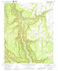
1953 Map of Navajo Peak
USGS Topo · Published 1980About this map
Rio Chama carves a deep path through this Rio Arriba landscape, serving as the central axis for a region defined by high mesas and intricate canyon systems. The map captures a high-desert environment where early human history is marked by Cliff Dwellings and unnamed Ruins situated near the river's path, while later agricultural history is anchored at the Juan Gallegos Ranch to the south. The transition between the Santa Fe National Forest and the Carson National Forest occurs across the plateau of Mesa de los Viejos. Transportation through this steep terrain is primarily limited to routes like the Hall Pack Trail, while water access for livestock or travelers is noted by scattered improvements such as Sargent Tank and Golondrino Tank. Peaks like Navajo Peak and the prominent ridge of The Hogback dominate the western horizon, overlooking the winding confluence of the Rio Gallina.
Find a feature on this map
30 named features on this map. Tap any name to fly to it.
Don’t see what you’re looking for? This feature index may not catch every label — zoom into the map to look around manually.
Map Details
Editions of this 1953 Navajo Peak Map
4 editions found
Other maps of this area

1909 · Gallina
USGS Topo · 1:125,000

1953 · Alire
USGS Topo · 1:24,000

1953 · Echo Ampitheater
USGS Topo · 1:24,000

1953 · Laguna Peak
USGS Topo · 1:24,000

1953 · Navajo Peak
USGS Topo · 1:24,000

1954 · Aztec
USGS Topo · 1:250,000

1955 · Llaves
USGS Topo · 1:62,500

1955 · Tierra Amarilla
USGS Topo · 1:62,500

1955 · Boulder Lake
USGS Topo · 1:62,500

1958 · Aztec
USGS Topo · 1:250,000