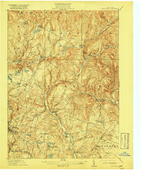
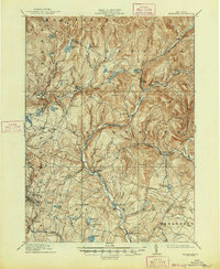
1910 Map of Neversink
USGS Topo · Published 1917About this map
The Neversink River carves a deep path through the Catskills in this 1910 survey, serving as the central artery for a landscape defined by high peaks and narrow valleys. This pre-reservoir era map captures the upper Neversink valley before significant hydrological changes, showing the original riverbed winding past settlements like Neversink and Hasbrouck. In the southern reaches, the Ontario and Western railroad skirts the edge of the mountains, connecting Ferndale to the broader regional economy. The map reveals a dense network of water bodies, from Mongaup Pond in the north to Loch Sheldrake in the south, illustrating the area's early 20th-century character as a destination for summer retreats and dairy farming. Small hamlets like Grahamsville and Claryville are shown in their original configurations, centered around local landmarks such as Union Church.
Find a feature on this map
80 named features on this map. Tap any name to fly to it.
Don’t see what you’re looking for? This feature index may not catch every label — zoom into the map to look around manually.
Map Details
Editions of this 1910 Neversink Map
6 editions found
Other maps of this area

1900 · Phoenicia
USGS Topo · 1:62,500

1901 · Margaretville
USGS Topo · 1:62,500

1903 · Phoenicia
USGS Topo · 1:62,500

1903 · Slide Mountain
USGS Topo · 1:62,500

1904 · Margaretville
USGS Topo · 1:62,500

1904 · Ellenville
USGS Topo · 1:62,500

1905 · Slide Mountain
USGS Topo · 1:62,500

1906 · Ellenville
USGS Topo · 1:62,500

1909 · Monticello
USGS Topo · 1:62,500

1910 · Neversink
USGS Topo · 1:62,500