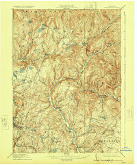
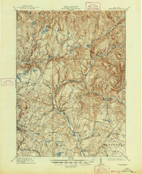
1910 Map of Neversink
USGS Topo · Published 1924About this map
Grahamsville and Woodbourne anchor the southern valleys of this region before the mid-century creation of major reservoirs. The landscape is defined by the winding course of the Neversink River and the Willowemoc Creek, which supported numerous small lakeside and riverside communities. In the southwest, the Ontario and Western RR cuts through Liberty and Ferndale, facilitating travel and trade during this era of upstate expansion. Numerous smaller settlements and landings like Divine Corners, Eureka, and Claryville are shown at their peak, connected by early mountain roads. The map also documents a high concentration of named water bodies such as Loch Sheldrake, Mongaup Pond, and Hunter Pond, which helped establish the area as a destination for seasonal visitors and local industry.
Find a feature on this map
72 named features on this map. Tap any name to fly to it.
Don’t see what you’re looking for? This feature index may not catch every label — zoom into the map to look around manually.
Map Details
Editions of this 1910 Neversink Map
6 editions found
Other maps of this area

1900 · Phoenicia
USGS Topo · 1:62,500

1901 · Margaretville
USGS Topo · 1:62,500

1903 · Phoenicia
USGS Topo · 1:62,500

1903 · Slide Mountain
USGS Topo · 1:62,500

1904 · Margaretville
USGS Topo · 1:62,500

1904 · Ellenville
USGS Topo · 1:62,500

1905 · Slide Mountain
USGS Topo · 1:62,500

1906 · Ellenville
USGS Topo · 1:62,500

1909 · Monticello
USGS Topo · 1:62,500

1910 · Neversink
USGS Topo · 1:62,500