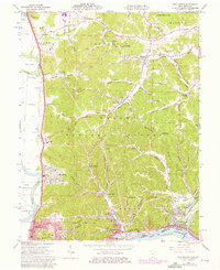
1961 Map of New Boston
USGS Topo · Published 1976About this map
The industrial corridor of the Scioto River dominates this mid-century portrait of southern Ohio, where the city of Portsmouth and New Boston meet the hills. Heavy rail infrastructure, including the Norfolk and Western and Baltimore and Ohio lines, traces the riverbanks, supporting the growth of neighborhoods like North Moreland and Eden Park. Beyond the urban core, the landscape transitions into the wooded ridges of the Wayne National Forest, where remnants of earlier industry appear in names like Harrison Furnace Creek.
Find a feature on this map
99 named features on this map. Tap any name to fly to it.
Don’t see what you’re looking for? This feature index may not catch every label — zoom into the map to look around manually.
Map Details
Editions of this 1961 New Boston Map
Other maps of this area

1911 · Sciotoville
USGS Topo · 1:62,500

1913 · Sciotoville
USGS Topo · 1:62,500

1915 · Garrison
USGS Topo · 1:62,500

1915 · Otway
USGS Topo · 1:62,500

1917 · Otway
USGS Topo · 1:62,500

1918 · Garrison
USGS Topo · 1:62,500

1926 · Greenup
USGS Topo · 1:48,000

1930 · Greenup
USGS Topo · 1:62,500

1949 · Friendship
USGS Topo · 1:24,000
1951 · Friendship
USGS Topo · 1:24,000