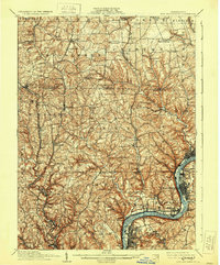
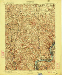
1910 Map of New Kensington
USGS Topo · Published 1930About this map
The Allegheny River defines the industrial and geographic character of this region, winding past the growing centers of New Kensington, Arnold, and Parnassus. In the early 20th century, these riverfront communities were hubs of aluminum manufacturing and glass production, visible here before extensive modern expansion. To the north and west, the landscape transitions into a series of smaller rural settlements like Saxonburg and Bakerstown, connected by a network of runs and creeks such as Deer Creek and Glade Run.
Find a feature on this map
78 named features on this map. Tap any name to fly to it.
Don’t see what you’re looking for? This feature index may not catch every label — zoom into the map to look around manually.
Map Details
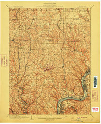
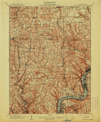
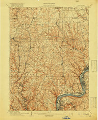
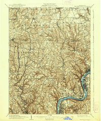
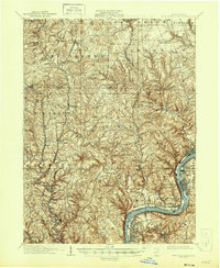
Editions of this 1910 New Kensington Map
7 editions found
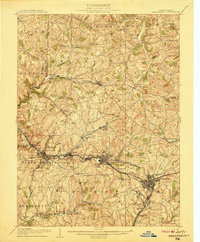
Other maps of this area

1900 · Kittanning
USGS Topo · 1:62,500

1902 · Kittanning
USGS Topo · 1:62,500

1904 · Mc Keesport
USGS Topo · 1:62,500

1904 · Carnegie
USGS Topo · 1:62,500

1904 · Greensburg
USGS Topo · 1:62,500

1906 · Carnegie
USGS Topo · 1:62,500
1906 · Greensburg
USGS Topo · 1:62,500

1906 · Sewickley
USGS Topo · 1:62,500

1907 · Pittsburg
USGS Topo · 1:62,500

1907 · Freeport
USGS Topo · 1:62,500