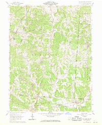
1961 Map of New Plymouth
USGS Topo · Published 1971About this map
New Plymouth and the surrounding rural townships of Hocking and Vinton Counties appear here during a period of transition in the early 1960s. The landscape is defined by the legacy of the Ohio Company Purchase, with land lines and boundaries reflecting early private subdivisions. Resource extraction is evident through numerous Strip Mines and oil wells scattered across the ridges, such as Harble Ridge and Calico Ridge.
Find a feature on this map
46 named features on this map. Tap any name to fly to it.
Don’t see what you’re looking for? This feature index may not catch every label — zoom into the map to look around manually.
Map Details
Editions of this 1961 New Plymouth Map
4 editions found
Other maps of this area

1904 · Zaleski
USGS Topo · 1:62,500

1907 · Zaleski
USGS Topo · 1:62,500

1907 · Logan
USGS Topo · 1:62,500

1907 · Lancaster
USGS Topo · 1:62,500

1909 · Lancaster
USGS Topo · 1:62,500

1909 · Logan
USGS Topo · 1:62,500

1910 · Laurelville
USGS Topo · 1:62,500

1912 · Laurelville
USGS Topo · 1:62,500

1944 · Laurelville
USGS Topo · 1:62,500

1947 · Columbus
USGS Topo · 1:250,000