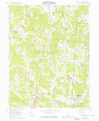
1961 Map of New Plymouth
USGS Topo · Published 1976About this map
New Plymouth and the surrounding townships of Falls, Green, and Washington appear here as they were during the early 1960s, with later updates from the mid-1970s. The landscape is defined by the deep dissection of Harble Ridge and Calico Ridge, where the terrain is heavily marked by industrial activity. Numerous areas labeled Strip Mine are scattered across the hills, particularly near Ilesboro and Metz, indicating the significance of the region's coal or mineral extraction economy.
Find a feature on this map
44 named features on this map. Tap any name to fly to it.
Don’t see what you’re looking for? This feature index may not catch every label — zoom into the map to look around manually.
Map Details
Editions of this 1961 New Plymouth Map
4 editions found
Other maps of this area

1904 · Zaleski
USGS Topo · 1:62,500

1907 · Zaleski
USGS Topo · 1:62,500

1907 · Logan
USGS Topo · 1:62,500

1907 · Lancaster
USGS Topo · 1:62,500

1909 · Lancaster
USGS Topo · 1:62,500

1909 · Logan
USGS Topo · 1:62,500

1910 · Laurelville
USGS Topo · 1:62,500

1912 · Laurelville
USGS Topo · 1:62,500

1944 · Laurelville
USGS Topo · 1:62,500

1947 · Columbus
USGS Topo · 1:250,000