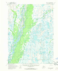
1955 Map of Noatak C-2
USGS Topo · Published 1970About this map
The settlement of Noatak sits at the western edge of this mid-century survey, positioned near a designated Landing Strip along the winding course of the Noatak River. The landscape is dominated by the complex hydrological networks of the Arctic, where the river braids into numerous channels and oxbows across a broad floodplain. To the east, the Eli River meanders toward its confluence, flanked by a dense pattern of small tundra lakes and ponds.
Find a feature on this map
7 named features on this map. Tap any name to fly to it.
Don’t see what you’re looking for? This feature index may not catch every label — zoom into the map to look around manually.
Map Details
Editions of this 1955 Noatak C-2 Map
3 editions found
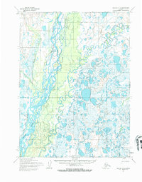
Other maps of this area

1951 · Noatak
USGS Topo · 1:250,000

1955 · Noatak
USGS Topo · 1:250,000

1955 · Noatak D-1
USGS Topo · 1:63,360

1955 · Noatak D-3
USGS Topo · 1:63,360

1955 · Noatak D-2
USGS Topo · 1:63,360

1955 · Noatak C-2
USGS Topo · 1:63,360

1955 · Noatak B-3
USGS Topo · 1:63,360

1955 · Noatak C-1
USGS Topo · 1:63,360

1955 · Noatak C-3
USGS Topo · 1:63,360

1955 · Noatak B-2
USGS Topo · 1:63,360