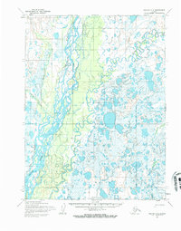
1955 Map of Noatak C-2
USGS Topo · Published 1970About this map
Noatak stands as a focal point in this 1950s study of the Northwest Arctic, situated along the complex braided channels of the Noatak River. The landscape is dominated by the confluence of major waterways, including the Eli River and Kuchak Creek, which weave through a dense network of lakes and marshes. A prominent Landing Strip near the settlement underscores the importance of aerial access in this environment, while the presence of a Winter Trail highlights the seasonal nature of overland travel during this era. Mapped by the Army Map Service, the documentation of these shifting watercourses and established transport routes provides a clear look at the infrastructure supporting this remote northern community during the mid-20th century.
Find a feature on this map
6 named features on this map. Tap any name to fly to it.
Don’t see what you’re looking for? This feature index may not catch every label — zoom into the map to look around manually.
Map Details
Editions of this 1955 Noatak C-2 Map
3 editions found
Other maps of this area

1951 · Noatak
USGS Topo · 1:250,000

1955 · Noatak
USGS Topo · 1:250,000

1955 · Noatak D-1
USGS Topo · 1:63,360

1955 · Noatak D-3
USGS Topo · 1:63,360

1955 · Noatak D-2
USGS Topo · 1:63,360

1955 · Noatak C-2
USGS Topo · 1:63,360

1955 · Noatak B-3
USGS Topo · 1:63,360

1955 · Noatak C-1
USGS Topo · 1:63,360

1955 · Noatak C-3
USGS Topo · 1:63,360

1955 · Noatak B-2
USGS Topo · 1:63,360